You signed in with another tab or window. Reload to refresh your session.You signed out in another tab or window. Reload to refresh your session.You switched accounts on another tab or window. Reload to refresh your session.Dismiss alert
Inspired by SimAware (https://map.vatsim.net/) I would like to suggest the implementation of a possibility to display the actual approach sectors an APP/DEP station is covering instead of the circle around an airport.
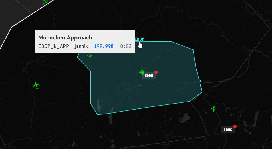
APP-Sectors which are implemented are displayed like this (e.g. München Approach):
APP-Sectors which are not implemented are displayed with circle around the airport as usual.
This feature would certainly improve the pilots awareness for the area an APP sector is covering or is not covering.
The text was updated successfully, but these errors were encountered:
Inspired by SimAware (https://map.vatsim.net/) I would like to suggest the implementation of a possibility to display the actual approach sectors an APP/DEP station is covering instead of the circle around an airport.
There would be no need to create a totally new database as there is already a public git project from which SimAware is getting his data: https://github.com/maiuswong/simaware-tracon-project
APP-Sectors which are implemented are displayed like this (e.g. München Approach):

APP-Sectors which are not implemented are displayed with circle around the airport as usual.
This feature would certainly improve the pilots awareness for the area an APP sector is covering or is not covering.
The text was updated successfully, but these errors were encountered: