A plugin to read raw kml file in - load google maps and overlay kml boundaries over map geo locations, international postcode lookup & resolve address from postcode feature
compile "org.grails.plugins:kml:0.4"
Boxset - play all 3 as a playlist
Part 1 Walk through urls and simple usage of plugin - very basic
Part 2 Walk through of how to build on new grails project from scratch
Part 3 Talk through code process / steps
kmlplugin{
    //TO USE MAP API FEATURE NEEDS TO BE ENABLED
    GOOGLE_API_KEY='YOUR GOOGLE API KEY'
    //This is total amount of local areas to collect for editing KML
    MAX_AREAS=30

    //How far to look for local areas in miles
    MAX_DISTANCE=30

    //This defines to enable map
    ENABLE_MAP_LOOKUP=true

    //By default treated as false
    DISABLE_LAT_LNG_LOOKUP=false

    // If you don't have API feature enabled on key disable this you get a developer map instead
    MAP_HAS_API_ENABLED=false


    //2 char country code of where your _default.kml belongs to so we can look up area names
    KML_COUNTRY='UK'

    // Internal folder to manage KML files - create and ensure web user has access
    KML_LOC="/opt/kmlplugin/_map/KML/"
    KML_HISTORY="/opt/kmlplugin/_map/KML_HISTORY/"

    //Drop this file in KML_LOC root folder - refer to notes below
    KML_DEFAULT="_default.kml"

    //This will re-run - recreate entries from _default.kml
    //if you are running in dev on h2 db - it is worth enabling this to add areas to db upon boot
    KML_RESET_FROM_DEFAULT=false
}
1. Lookup service : http://localhost:8080/lookup
This provides a page that given country / postcode will attempt to:
1.1: Lookup postcode and return as much of address as possible
1.2. If
ENABLE_MAP_LOOKUPis set to true andGOOGLE_API_KEYhas valid API access Will load map, put postcode on map & if KML boundaries loaded and matches will load in the area overlay on the map.
1.3 To disable features you can add any or all these to url line:
Other examples:
All passed variables to map and instance are not required but to show what above url params can be either posted or done as per above with instance being addition to params above for tag lib if you already have data this is what it is expecting to be sent to it
<map:lookup
showState="${false}"
showArea="${false}"
showLatLong="${false}"
streetRequired="${false}"
instance="${[
countrysearch:'',
countryCode:'',
postcode:'',
building:'',
street:'',
city:'',
state:'',
communitySearch:'',
latitude:'',
longitude:'',
]}"
/>
<!-- similar example with some data already set all of below
is enough to trigger maps / overlay - could be saved data -->
<map:lookup
showState="${false}"
showArea="${false}"
showLatLong="${false}"
streetRequired="${false}"
instance="${[
countrysearch:'United Kingdom',
countryCode:'UK',
postcode:'SE1 1AP',
building:'',
street:'',
city:'',
state:'',
communitySearch:'Southwark',
latitude:'51.5017828',
longitude:'-0.09326659999999999',
]}"
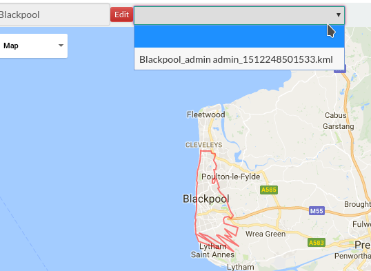
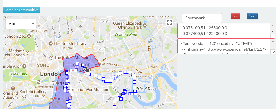
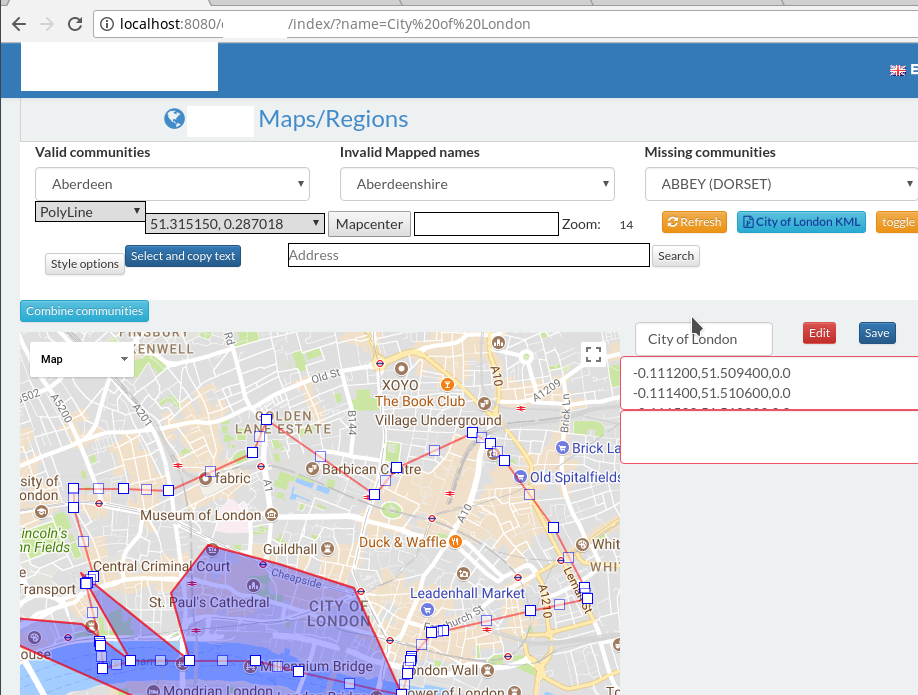
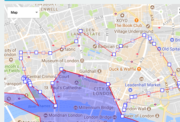
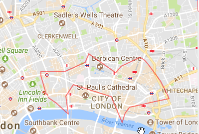
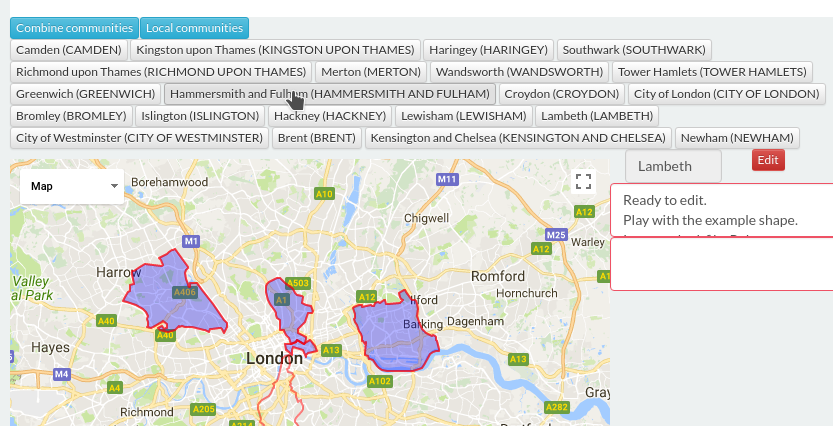
/>Map overlay editor : http://localhost:8080/map
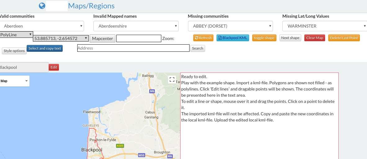
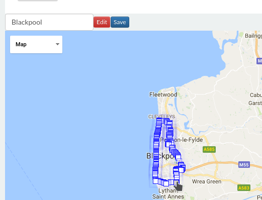
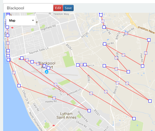
This provides an interface to edit and modify existing kml boundaries on the fly. It provides raw kml extracted file, has feature to upload, hasn't been tested.
You will need to take a copy of _address.gsp when verifyCode is called the data object returned contains full dump of
everything useful .
console.log(JSON.stringify(data)) will show all but 2 full data sets: data.latLongDetails and data.fullPostCodeDetails
/opt/kmlplugin/_map/KML/->
Place a file for the given country. This will be KML file you get hold of that contains typically all the official boroughs/councils of a given country in the case of UK we found:
was here Site appears to no longer work. You can get hold of file from here
This file was then stored in this folder as
_default.kml
/opt/kmlplugin/_map/KML/_default.kml
KmlHelper.parseKml()
When the site starts up for the very first time, it will attempt to read through this file and inside the same folder it will expand out all the found boroughs.
$ ls -rtml /opt/kmlplugin/_map/KML/|more
total 9876
-rw-rw-r-- 1 mx1 mx1 7394653 Nov 29 17:08 _default.kml
-rw-rw-r-- 1 mx1 mx1   19199 Dec  1 19:36 BEDFORDSHIRE.kml
-rw-rw-r-- 1 mx1 mx1   31337 Dec  1 19:36 BUCKINGHAMSHIRE.kml
-rw-rw-r-- 1 mx1 mx1   24338 Dec  1 19:36 CAMBRIDGESHIRE.kml
-rw-rw-r-- 1 mx1 mx1     584 Dec  1 19:36 CHESHIRE.kml
-rw-rw-r-- 1 mx1 mx1     584 Dec  1 19:36 CORNWALL.kml
-rw-rw-r-- 1 mx1 mx1     582 Dec  1 19:36 CUMBRIA.kml
At this point it has loaded up each borough and also split each borough/community into its own specific file.
This process happens only once and can be redone by clearing out and dropping in as above a _default.kml file.
This triggers an internal process to do what has been demonstrated.
Once it has been generated. The site will from there on refer to all created files to load up each community.
This means you can now edit each of the generated files for a given community and re-save it – a saved version and application restart will then ensure the site is using whatever latest content each community has.
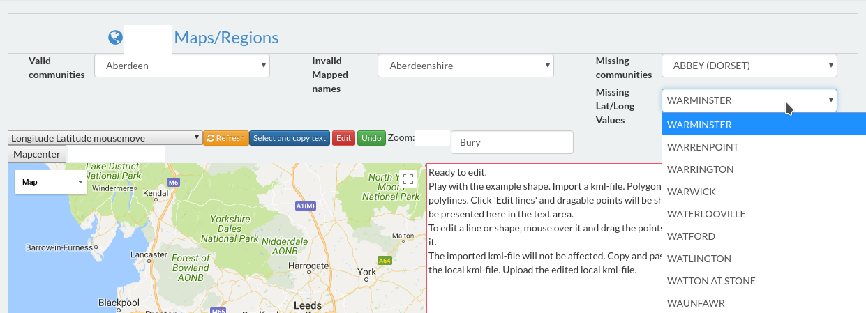
Upon start up you will need to visit the map regions and it will show what has been produced.
Add below to grails-app/conf/logback.groovy
    logger('org.grails.plugins.kml', ERROR, ['STDOUT'], false)
    logger('org.grails.plugins.kml', DEBUG, ['STDOUT'], false)
    logger('org.grails.plugins.kml', WARN, ['STDOUT'], false)
    logger('org.grails.plugins.kml', INFO, ['STDOUT'], false)
##Credits
KML Map editor or /map segement is thanks to above link which gave the source to build the rest as such.
His worked got wired into what the rest of the code does, as per what his page expected.
Please note - KML Parsing utiltiy. I put this class together as an expansion from this question on SO extract-coordinates-from-kml-file-in-java. Since this plugin is currently functional with provided kml file, any one who has additional time and wishes to come on board and improve KML Parsing to work with other standards or any other aspect of this plugin, I be happy to accept their input. This isn't something I'm currently using and was put together for another project, decided to release into public realm since I guess it is a bit of magic.